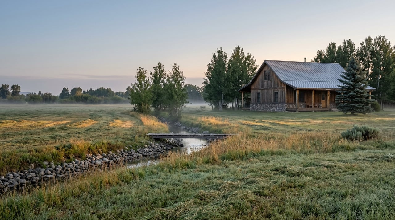
Two ranches can share a fence line in Old Snowmass. Same creek bending across both properties. Same view of Mount Sopris from the kitchen window. Same phrase, "irrigated hay meadow," sitting in the listing description. In an ordinary year, that similarity mostly holds. Water shows up, pastures green, nobody thinks much about the piece of paper that actually authorizes any of it.
This was not an ordinary year. The Roaring Fork basin had its lowest snowpack since telemetric monitoring began in 1981, and by the time streams usually peak in early April, the readings had collapsed further to around a quarter of normal. Aspen spent the summer under its strictest water shortage stage on record. And for the first time in a long while, the question of who actually has the right to divert water, and when, stopped being paperwork and started being the thing that decided which ranches came through the season intact.
The Ditch That Explains the Difference
The Aspen Daily News has reported on a real example of how this plays out in Old Snowmass, involving a name most people recognize for entirely different reasons.
In the late 1970s, John Denver assembled a 957-acre parcel along Snowmass Creek that came to be known as the Windstar property, home for years to the Windstar Foundation, the environmental organization he founded. In 2017, an entity called Five Valley Farm LLC paid $8.5 million for that land. The parcel sits immediately next to the 203-acre High Mesa Ranch, and both properties draw irrigation water from the same source: the Walker Wonder Ditch, a shared irrigation channel that carries Snowmass Creek water to both parcels.
That single fact means the two properties are tied together in ways a survey plat never shows. High Mesa Ranch had, in the years before that sale, gone through Pitkin County approvals for a new barn, a leveled 47-acre pasture built to double as a polo field, and a long driveway lined with imported boulders, all of it dependent on water moving reliably through a ditch that also has to serve the neighbor. A neighboring landowner on the Snowmass Creek side of High Mesa Ranch had, separately, been working with the ranch's land managers just to relocate irrigation pipelines crossing the property. None of that infrastructure or coordination shows up on a plat map. It shows up when you ask who else is on your ditch, how the ditch company is governed, and what happens when the creek feeding all of it runs short.
Most years, that question stays theoretical. This year it stopped being theoretical for the entire watershed.
A Winter That Broke the Record Books
By mid-March, snowpack in the Roaring Fork Valley basin measured 65 percent of normal, already the lowest level recorded since the modern telemetric snowpack system started tracking data in 1981. Then March turned out to be the warmest on record in 132 years of Colorado climate data, and the little snow that had accumulated melted off nearly a month early. By the time snowpack traditionally peaks in early April, the Roaring Fork basin had fallen further, to around 26 percent of normal.
The runoff numbers that followed told the rest of the story. Aspen's water supply comes from Castle and Maroon Creeks, and June streamflow across the Roaring Fork watershed measured just 27 percent of normal. Maroon Creek's peak runoff for the year hit only 143 cubic feet per second on June 7, compared with a historical average peak of over 300 cfs typically reached between June 15 and June 30. By July, Aspen and Pitkin County were sitting in Exceptional Drought, the U.S. Drought Monitor's highest category, and the city had been under Stage Three water restrictions since May 15, limiting outdoor irrigation to two assigned days a week and banning the filling of pools and hot tubs entirely.
Rebecca Briesmoore, a water resources engineer with the Colorado River District, put it plainly to a packed room at a Roaring Fork River state-of-the-basin meeting in May. This year, she said, was "like nothing we have ever seen before."
The strain wasn't confined to town water systems. Ranchers across the Western Slope faced a harder version of the same math this spring, with hay meadows coming up short and some facing a choice between buying feed or thinning their herds. That is the practical, on-the-ground consequence of a water right that cannot deliver its full decreed amount in a year like this one.
What a Priority Date Actually Buys You
The Colorado Division of Water Resources describes Colorado's prior appropriation doctrine, summarized locally as first in time, first in right. Rights with older priority dates get satisfied first when a stream runs low. Everyone junior to that date can be curtailed, sometimes entirely, until the senior right is met.
Most Old Snowmass ranches do not divert straight from a creek on their own. They hold shares in a mutual ditch company, a private entity that owns the decreed right and delivers water to shareholders through a shared network of headgates and channels, as the Colorado General Assembly describes for mutual ditch corporations. Owning a share does not guarantee a fixed volume of water. It guarantees a claim in line, and where you sit in that line depends on the decree behind the ditch, not on how the creek looks from your porch.
A few due diligence points matter more in a drought year than they do in a wet one:
- A creek or ditch crossing a property does not by itself grant any legal right to use that water. The right has to be adjudicated in water court, tied to a specific volume, use, and priority date.
- Colorado water rights carry a use-it-or-lose-it condition. A right that has not been put to consistent beneficial use can be vulnerable to abandonment, which makes historical usage records part of any serious review.
- The Colorado General Assembly recognizes that water rights can exist separately from the land they historically irrigated, so a title search focused only on the acreage can miss a right that was severed off years ago.
- Buyers should confirm whether other landowners share rights to the same ditch or headgate.
A Colorado ranch ownership checklist published by the Western Landowners Alliance makes a related point that gets missed constantly: off-site ditch infrastructure sometimes crosses land owned by the U.S. Forest Service or the Bureau of Land Management under an easement or permit, meaning part of a property's water delivery depends on paperwork filed with a federal agency, not just the county.
Why the Line on the Listing Sheet Now Matters More
None of this is new law. What changed this year is that the gap between a senior right and a junior one stopped being a hypothetical drawn from a hundred-year-old court decree and became something visible in real time, in reduced hay yields, in ditches running dry earlier than shareholders expected, in ranchers across the valley weighing whether to buy feed or sell cattle. A property description that lists "significant senior water rights" is disclosing an asset that behaved very differently this year than a similar-sounding phrase attached to a junior right.
For a buyer comparing two Old Snowmass properties with comparable acreage, comparable creek frontage, and comparable views, the priority date attached to each one is no longer a detail to confirm during due diligence. It is closer to the deciding variable, because this year gave everyone in the valley a preview of what a real shortage looks like on the ground.
Frequently Asked Questions
Does a private well provide the same protection as a ditch right? Not quite. Wells are regulated separately through the state's water administration system. The Colorado Division of Water Resources distinguishes well permits from decreed ditch rights: they are separate legal instruments, and a property can have one, both, or neither.
Can water rights be sold apart from the land they irrigate? Yes. Colorado treats water rights as real property that can be conveyed independently of the acreage they historically served. That is exactly why a title review focused only on boundary lines can miss a water right that was severed and sold off years earlier.
What happens to a junior water right when a senior user calls the river? It gets curtailed, sometimes to zero, until the senior right is satisfied. In a year with streamflow at a fraction of normal, that curtailment is not a distant possibility. It is the operating condition much of the valley experienced for weeks at a time this summer.
If you are weighing a ranch or acreage purchase in Old Snowmass and want to understand what sits behind a specific parcel's water right before you write an offer, Corey Crocker has spent her career reading exactly these details into a Roaring Fork Valley transaction. Reach out for a confidential conversation about what a property's water history actually means for its long-term value.
This article is general information, not legal, tax or financial advice. Consult a qualified professional about your situation.